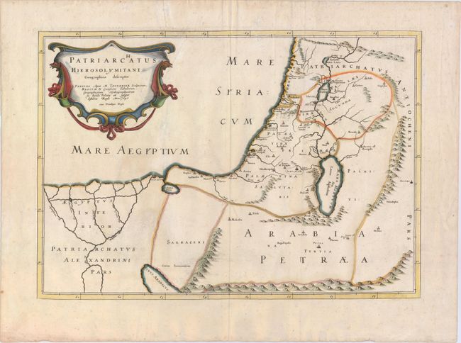
Title:
“Patriarchatus Hierosolymitani Geographica Descriptio”
Map Maker:
Melchior Tavernier
This is a handsome map covering the region from th... (full text available to subscribers)
| Item Detail |
| |
| |
MapMaker: |
Melchior Tavernier
|
|
| |
| |
Subject: |
Holy Land |
|
| |
Period/Size: |
1640 / 13.8" x 19.8" (35.1 x 50.3 cm)
|
|
| |
Color: |
Colored
|
|
| |
Condition: |
(B+) Watermarked paper with original outline color and later coloring in the cartouche. There is minor soiling and one short crack caused by the oxidation of the original green pigment that has been closed on verso with archival tape. (condition help) |
|
| |
Source: |
|
|
| |
References: |
Laor #768. |
|
| |
|
|
| Sales Information |
| |
| |
Price: |
|
|
| |
| |
Offered by: |
Old World Auctions |
|
| |
Catalog: |
Auction No. 148 - Antique Maps, Charts, Atlases & Globes (9227) |
|
| |
Lot/Item #: |
609 |
|
| |
| |
Date: |
02/2014
|
|
| |
| |
|
Antique Maps - Valuation and Pricing, Descriptions, Resources |
|
Home |
Information |
Search |
Register |
Contact Us |
Site Map
Americana Exchange, Inc. © 1999 - 2024 Americana Exchange, Inc.. All rights reserved.
OldMaps.com, the OldMaps.com logo and
AMPR are service marks or registered service marks of Americana Exchange, Inc..
|