Rister or Sign In to see pricing information


Title:

Regnum Salomonicum seu Tabula Digesta ad Libros

Map Maker:

Philippe De La Rue

Regnum Salomonicum seu Tabula Digesta ad Libros

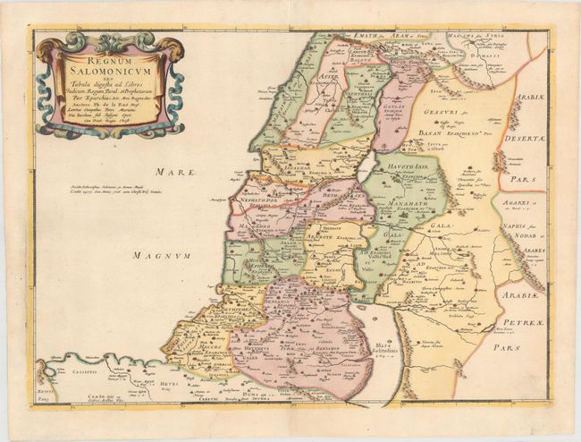
Very handsome map of the Holy Land during the reig... (full text available to subscribers)
Item Detail
 
  MapMaker:  

Philippe De La Rue


  Subject:  Holy Land  
  Period/Size:  1651 / 15.6" x 21.4"  (39.7 x 54.4 cm)  
  Color:  Colored  
  Condition:  (A) Lovely color on watermarked paper with one minute hole under title cartouche. (condition help)  
  Source:  La Terre Sainte en Six Cartes Geographiques…  
  References:  Laor #417; Pastoureau, LA RUE [3].  
 
 
Sales Information
 
  Price: 

Please register your email to view records, or sign in with email address to see records


  Offered by:  Old World Auctions  
  Catalog:  Auction No. 148 - Antique Maps, Charts, Atlases & Globes (9227)  
  Lot/Item #:  610  
 
  Date:  02/2014  


Antique Maps - Valuation and Pricing, Descriptions, Resources


Home | Information | Search | Register | Contact Us | Site Map

Americana Exchange, Inc. © 1999 - 2024 Americana Exchange, Inc.. All rights reserved. OldMaps.com, the OldMaps.com logo and
AMPR are service marks or registered service marks of Americana Exchange, Inc..