Title:
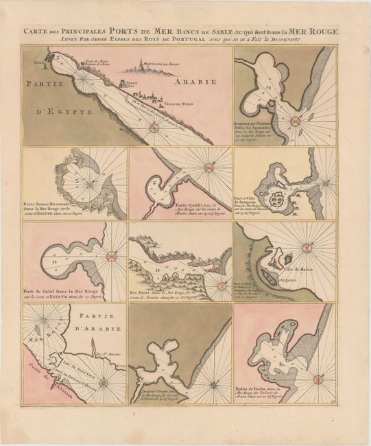
“Carte des Principales Ports de Mer Bancs de Sable &c.: Qui sont dans la Mer Rouge Levee par Ordre Expres des Roys de Portugal sous qui on en a Fait la Decouverte”
Map Maker:
Pierre Mortier
The bays and safe anchorages in the Red Sea are ma... (full text available to subscribers)
| Item Detail |
| |
| |
MapMaker: |
Pierre Mortier
|
|
| |
| |
Subject: |
Red Sea |
|
| |
Period/Size: |
1720 / 19.9" x 16.8" (50.6 x 42.7 cm)
|
|
| |
Color: |
Colored
|
|
| |
Condition: |
(A) A fine impression with full original color on watermarked paper. There are a few professionally repaired cracks caused by the oxidation of the green pigment. (condition help) |
|
| |
Source: |
Neptune Francais |
|
| |
References: |
|
|
| |
|
|
| Sales Information |
| |
| |
Price: |
|
|
| |
| |
Offered by: |
Old World Auctions |
|
| |
Catalog: |
Auction No. 148 - Antique Maps, Charts, Atlases & Globes (9227) |
|
| |
Lot/Item #: |
628 |
|
| |
| |
Date: |
02/2014
|
|
| |
| |
|
Antique Maps - Valuation and Pricing, Descriptions, Resources |
|
Home |
Information |
Search |
Register |
Contact Us |
Site Map
Americana Exchange, Inc. © 1999 - 2024 Americana Exchange, Inc.. All rights reserved.
OldMaps.com, the OldMaps.com logo and
AMPR are service marks or registered service marks of Americana Exchange, Inc..
|