Title:
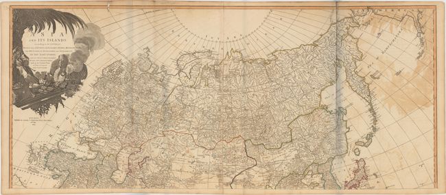
“Asia and Its Islands According to d'Anville: Divided into Empires, Kingdoms, States, Regions, with The European Possessions and Settlements in the East Indies…”
Map Maker:
Laurie & Whittle
A superb, large-scale map based on the cartography... (full text available to subscribers)
| Item Detail |
| |
| |
MapMaker: |
Laurie & Whittle
|
|
| |
| |
Subject: |
Asia |
|
| |
Period/Size: |
1794 / 20.2" x 46.8" (51.3 x 118.9 cm)
|
|
| |
Color: |
Colored
|
|
| |
Condition: |
(C+) Issued on watermarked paper with moderate offsetting, brown stains, a 6-7" clean fold separation on each sheet, and two small holes along the top border. (condition help) |
|
| |
Source: |
A New Universal Atlas… |
|
| |
References: |
|
|
| |
|
|
| Sales Information |
| |
| |
Price: |
|
|
| |
| |
Offered by: |
Old World Auctions |
|
| |
Catalog: |
Auction No. 148 - Antique Maps, Charts, Atlases & Globes (9227) |
|
| |
Lot/Item #: |
647 |
|
| |
| |
Date: |
02/2014
|
|
| |
| |
|
Antique Maps - Valuation and Pricing, Descriptions, Resources |
|
Home |
Information |
Search |
Register |
Contact Us |
Site Map
Americana Exchange, Inc. © 1999 - 2024 Americana Exchange, Inc.. All rights reserved.
OldMaps.com, the OldMaps.com logo and
AMPR are service marks or registered service marks of Americana Exchange, Inc..
|