Title:
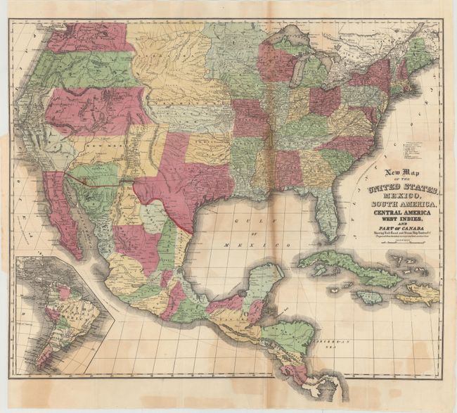
“New Map of the United States, Mexico, South America, Central America West Indies, and Part of Canada Showing Rail-Road and Steam Ship Routes &c…”
Map Maker:
Case, Tiffany & Company
This is an uncommon updated version of the Case, T... (full text available to subscribers)
| Item Detail |
| |
| |
MapMaker: |
Case, Tiffany & Company
|
|
| |
| |
Subject: |
North America |
|
| |
Period/Size: |
1856 / 21.6" x 24.7" (54.9 x 62.8 cm)
|
|
| |
Color: |
Colored
|
|
| |
Condition: |
(B) Issued folding with light color offsetting, toning along one fold, and a 0.75" by 0.15" area of loss in western Tennessee that has been closed on verso with old paper. Binding trim at left. (condition help) |
|
| |
Source: |
|
|
| |
References: |
|
|
| |
|
|
| Sales Information |
| |
| |
Price: |
|
|
| |
| |
Offered by: |
Old World Auctions |
|
| |
Catalog: |
Auction No. 149 - Antique Maps, Charts, Atlases & Globes (9228) |
|
| |
Lot/Item #: |
96 |
|
| |
| |
Date: |
05/2014
|
|
| |
| |
|
Antique Maps - Valuation and Pricing, Descriptions, Resources |
|
Home |
Information |
Search |
Register |
Contact Us |
Site Map
Americana Exchange, Inc. © 1999 - 2024 Americana Exchange, Inc.. All rights reserved.
OldMaps.com, the OldMaps.com logo and
AMPR are service marks or registered service marks of Americana Exchange, Inc..
|