| Item Detail |
| |
| |
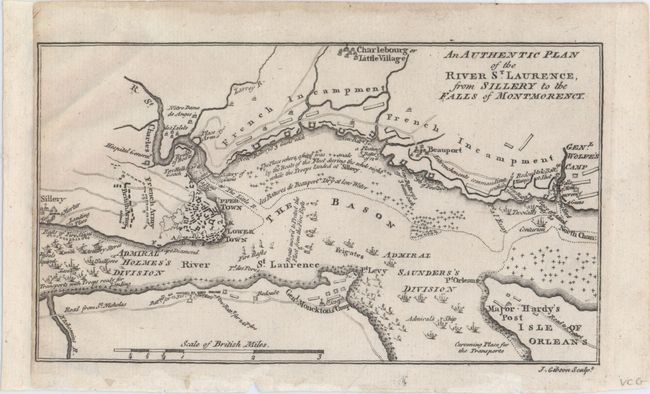
MapMaker: |
John Gibson
|
|
| |
| |
Subject: |
Quebec City, Canada |
|
| |
Period/Size: |
1759 / 4.3" x 7.4" (11.0 x 18.8 cm)
|
|
| |
Color: |
Black & White
|
|
| |
Condition: |
(A) The sheet has been remargined at left with old paper. There are remnants of hinge tape on the verso and a faint damp stain along the top edge of the sheet that does not enter image. (condition help) |
|
| |
Source: |
Gentleman's Magazine |
|
| |
References: |
Jolly #GENT-137. |
|
| |
|
|
| Sales Information |
| |
| |
Price: |
|
|
| |
| |
Offered by: |
Old World Auctions |
|
| |
Catalog: |
Auction No. 149 - Antique Maps, Charts, Atlases & Globes (9228) |
|
| |
Lot/Item #: |
106 |
|
| |
| |
Date: |
05/2014
|
|
| |
| |
|