| Item Detail |
| |
| |
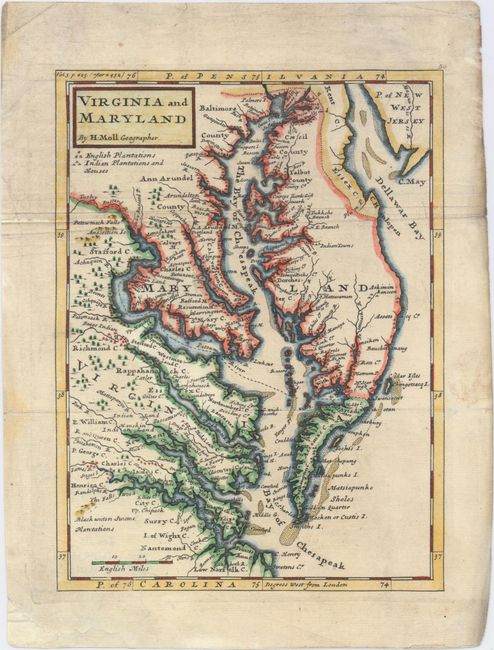
MapMaker: |
Herman Moll
|
|
| |
| |
Subject: |
Colonial Mid-Atlantic United States |
|
| |
Period/Size: |
1729 / 10.6" x 7.9" (27.0 x 20.1 cm)
|
|
| |
Color: |
Colored
|
|
| |
Condition: |
(B+) Issued folding, now pressed, with some extraneous creasing along top fold, marginal soiling, and a professionally repaired chip confined to bottom blank margin. (condition help) |
|
| |
Source: |
Atlas Minor |
|
| |
References: |
Stephenson & McKee #II-16; Wooldridge #86; Shirley (BL Atlases) T.MOLL-9a #54. |
|
| |
|
|
| Sales Information |
| |
| |
Price: |
|
|
| |
| |
Offered by: |
Old World Auctions |
|
| |
Catalog: |
Auction No. 149 - Antique Maps, Charts, Atlases & Globes (9228) |
|
| |
Lot/Item #: |
146 |
|
| |
| |
Date: |
05/2014
|
|
| |
| |
|