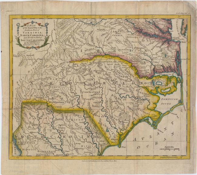
Title:
“A Map of the Seat of War in the Southern Part of Virginia, North Carolina, and Northern Part of South Carolina”
Map Maker:
Thomas Kitchin
This map depicts the southern theater of war durin... (full text available to subscribers)
| Item Detail |
| |
| |
MapMaker: |
Thomas Kitchin
|
|
| |
| |
Subject: |
Colonial Southeast |
|
| |
Period/Size: |
1781 / 10.9" x 13.6" (27.7 x 34.6 cm)
|
|
| |
Color: |
Colored
|
|
| |
Condition: |
(B+) Issued folding on watermarked paper, now pressed with minor soiling and professional repairs to a few tiny holes at fold intersections. There is a binding trim at right that has been replaced with old paper, and an associated binding tear that enter (condition help) |
|
| |
Source: |
London Magazine |
|
| |
References: |
Jolly #LOND-342. |
|
| |
|
|
| Sales Information |
| |
| |
Price: |
|
|
| |
| |
Offered by: |
Old World Auctions |
|
| |
Catalog: |
Auction No. 149 - Antique Maps, Charts, Atlases & Globes (9228) |
|
| |
Lot/Item #: |
160 |
|
| |
| |
Date: |
05/2014
|
|
| |
| |
|
Antique Maps - Valuation and Pricing, Descriptions, Resources |
|
Home |
Information |
Search |
Register |
Contact Us |
Site Map
Americana Exchange, Inc. © 1999 - 2024 Americana Exchange, Inc.. All rights reserved.
OldMaps.com, the OldMaps.com logo and
AMPR are service marks or registered service marks of Americana Exchange, Inc..
|