Title:
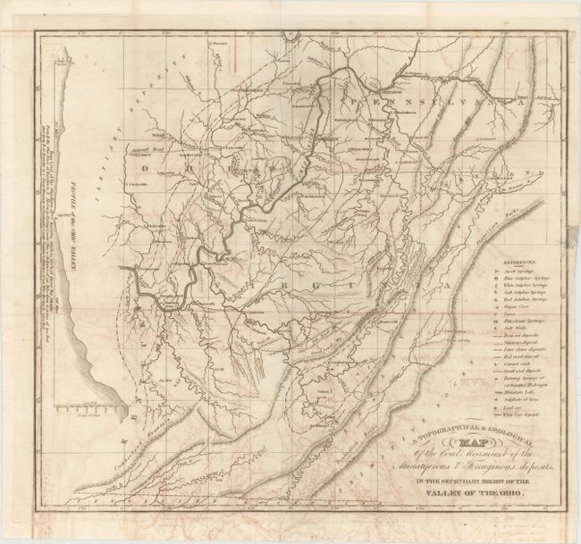
“A Topographical & Geological Map of the Coal Measures, & of the Muriatiferous & Ferruginous Deposits, in the Secondary Region of the Valley of the Ohio”
Map Maker:
American Journal of Science
This is one of the earliest geological maps of ... (full text available to subscribers)
| Item Detail |
| |
| |
MapMaker: |
American Journal of Science
|
|
| |
| |
Subject: |
West Virginia, Ohio, Pennsylvania |
|
| |
Period/Size: |
1836 / 14.9" x 16.4" (37.9 x 41.7 cm)
|
|
| |
Color: |
Black & White
|
|
| |
Condition: |
(B) Issued folding with moderate offsetting and a short binding tear at right that has been closed on verso with archival tape. (condition help) |
|
| |
Source: |
American Journal of Science and Arts, Vol. 29 |
|
| |
References: |
Marcou #353. |
|
| |
|
|
| Sales Information |
| |
| |
Price: |
|
|
| |
| |
Offered by: |
Old World Auctions |
|
| |
Catalog: |
Auction No. 149 - Antique Maps, Charts, Atlases & Globes (9228) |
|
| |
Lot/Item #: |
182 |
|
| |
| |
Date: |
05/2014
|
|
| |
| |
|
Antique Maps - Valuation and Pricing, Descriptions, Resources |
|
Home |
Information |
Search |
Register |
Contact Us |
Site Map
Americana Exchange, Inc. © 1999 - 2024 Americana Exchange, Inc.. All rights reserved.
OldMaps.com, the OldMaps.com logo and
AMPR are service marks or registered service marks of Americana Exchange, Inc..
|