| Item Detail |
| |
| |
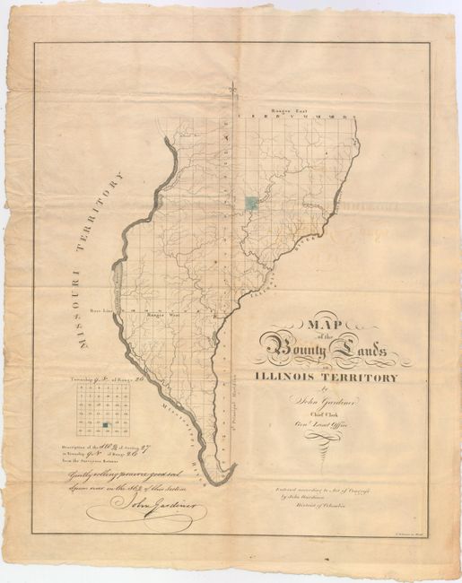
MapMaker: |
John Gardiner
|
|
| |
| |
Subject: |
Western Illinois |
|
| |
Period/Size: |
1818 / 18.6" x 14.9" (47.3 x 37.9 cm)
|
|
| |
Color: |
Black & White
|
|
| |
Condition: |
(B) Issued folding with light toning and offsetting and a few minor spots of foxing. There are two small holes along the vertical fold with minute and insignificant loss or image: one to the left of the highlighted tract and one to the right of the fleur (condition help) |
|
| |
Source: |
|
|
| |
References: |
Streeter #1430; Phillips (Maps) pg. 326. |
|
| |
|
|
| Sales Information |
| |
| |
Price: |
|
|
| |
| |
Offered by: |
Old World Auctions |
|
| |
Catalog: |
Auction No. 149 - Antique Maps, Charts, Atlases & Globes (9228) |
|
| |
Lot/Item #: |
240 |
|
| |
| |
Date: |
05/2014
|
|
| |
| |
|