| Item Detail |
| |
| |
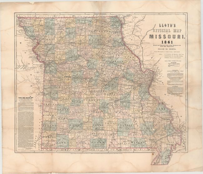
MapMaker: |
James T. Lloyd
|
|
| |
| |
Subject: |
Missouri |
|
| |
Period/Size: |
1861 / 23.6" x 26.6" (60.0 x 67.6 cm)
|
|
| |
Color: |
Colored
|
|
| |
Condition: |
(B) Issued folding and now flattened with heavy tissue to reinforce and repair several short centerfold separations and a few small holes at fold intersections, which resulted in some minor loss of image. Several large damp stains are visible in the imag (condition help) |
|
| |
Source: |
|
|
| |
References: |
Stephenson (CW) #296.3. |
|
| |
|
|
| Sales Information |
| |
| |
Price: |
|
|
| |
| |
Offered by: |
Old World Auctions |
|
| |
Catalog: |
Auction No. 149 - Antique Maps, Charts, Atlases & Globes (9228) |
|
| |
Lot/Item #: |
255 |
|
| |
| |
Date: |
05/2014
|
|
| |
| |
|