| Item Detail |
| |
| |
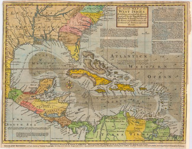
MapMaker: |
Emanuel Bowen
|
|
| |
| |
Subject: |
Gulf of Mexico and Caribbean |
|
| |
Period/Size: |
1740 / 11.6" x 15.2" (29.5 x 38.6 cm)
|
|
| |
Color: |
Colored
|
|
| |
Condition: |
(B+) Issued folding, now flat. The margins are trimmed close to the neatline at top, left, and right, with the right margin extended to better accommodate framing. Two tiny holes that are only visible when held to light appear along one fold. (condition help) |
|
| |
Source: |
Gentleman's Magazine |
|
| |
References: |
Jolly #GENT-6; Sellers & Van Ee #1681. |
|
| |
|
|
| Sales Information |
| |
| |
Price: |
|
|
| |
| |
Offered by: |
Old World Auctions |
|
| |
Catalog: |
Auction No. 149 - Antique Maps, Charts, Atlases & Globes (9228) |
|
| |
Lot/Item #: |
336 |
|
| |
| |
Date: |
05/2014
|
|
| |
| |
|