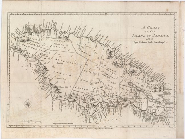
Title:
“A Chart of the Island of Jamaica, with Its Bays, Harbours, Rocks, Soundings, &c.”
Map Maker:
John Bew
This striking map of Jamaica is divided into the c... (full text available to subscribers)
| Item Detail |
| |
| |
MapMaker: |
John Bew
|
|
| |
| |
Subject: |
Jamaica |
|
| |
Period/Size: |
1780 / 10.2" x 15.0" (25.9 x 38.1 cm)
|
|
| |
Color: |
Black & White
|
|
| |
Condition: |
(B) Issued folding, now flattened, on watermarked paper with light offsetting and a couple fold separations that have been closed on verso with archival materials. There is a binding trim at right that has been replaced with old paper and an associated 2 (condition help) |
|
| |
Source: |
Political Magazine |
|
| |
References: |
Jolly #POL-10. |
|
| |
|
|
| Sales Information |
| |
| |
Price: |
|
|
| |
| |
Offered by: |
Old World Auctions |
|
| |
Catalog: |
Auction No. 149 - Antique Maps, Charts, Atlases & Globes (9228) |
|
| |
Lot/Item #: |
353 |
|
| |
| |
Date: |
05/2014
|
|
| |
| |
|
Antique Maps - Valuation and Pricing, Descriptions, Resources |
|
Home |
Information |
Search |
Register |
Contact Us |
Site Map
Americana Exchange, Inc. © 1999 - 2024 Americana Exchange, Inc.. All rights reserved.
OldMaps.com, the OldMaps.com logo and
AMPR are service marks or registered service marks of Americana Exchange, Inc..
|