| Item Detail |
| |
| |
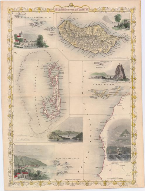
MapMaker: |
John Tallis
|
|
| |
| |
Subject: |
Atlantic Islands |
|
| |
Period/Size: |
1850 / 13.9" x 9.8" (35.3 x 24.9 cm)
|
|
| |
Color: |
Colored
|
|
| |
Condition: |
(A) Original outline color with later color in the vignettes, a couple of insignificant spots in the image, and faint toning along the sheet's edges. (condition help) |
|
| |
Source: |
The Illustrated Atlas |
|
| |
References: |
|
|
| |
|
|
| Sales Information |
| |
| |
Price: |
|
|
| |
| |
Offered by: |
Old World Auctions |
|
| |
Catalog: |
Auction No. 149 - Antique Maps, Charts, Atlases & Globes (9228) |
|
| |
Lot/Item #: |
403 |
|
| |
| |
Date: |
05/2014
|
|
| |
| |
|