| Item Detail |
| |
| |
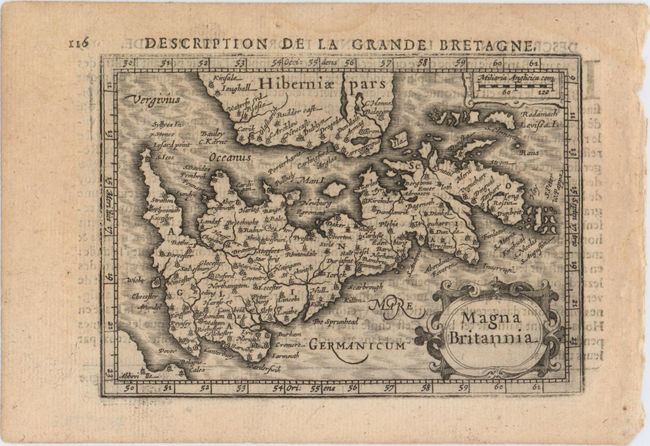
MapMaker: |
Hondius/Bertius
|
|
| |
| |
Subject: |
Britain |
|
| |
Period/Size: |
1618 / 3.9" x 5.4" (9.9 x 13.8 cm)
|
|
| |
Color: |
Black & White
|
|
| |
Condition: |
(A) A fine impression on watermarked paper with minor show-through of text on verso. (condition help) |
|
| |
Source: |
Tabularum Geographicarum Contractarum… |
|
| |
References: |
Shirley (BI to 1650) #348; King (2nd ed.) pp. 96-99; Van der Krogt (Vol. III) #5050:342. |
|
| |
|
|
| Sales Information |
| |
| |
Price: |
|
|
| |
| |
Offered by: |
Old World Auctions |
|
| |
Catalog: |
Auction No. 149 - Antique Maps, Charts, Atlases & Globes (9228) |
|
| |
Lot/Item #: |
419 |
|
| |
| |
Date: |
05/2014
|
|
| |
| |
|