| Item Detail |
| |
| |
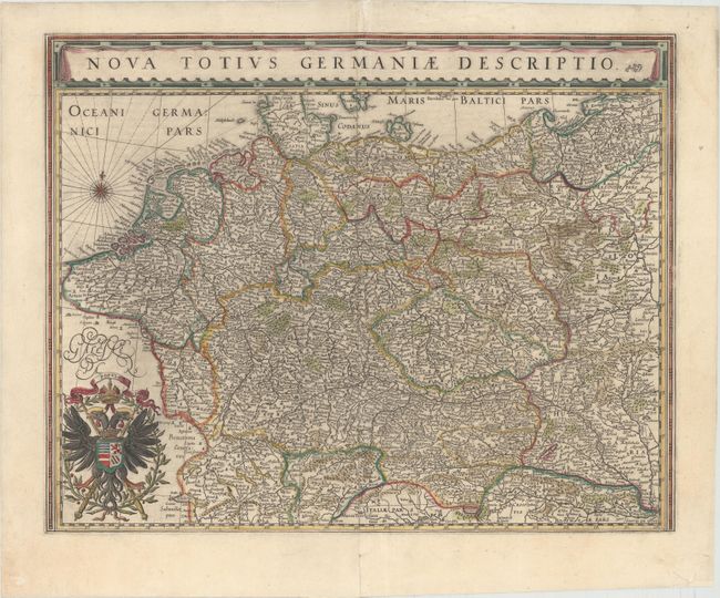
MapMaker: |
Blaeu [Family]
|
|
| |
| |
Subject: |
Central Europe, Germany |
|
| |
Period/Size: |
1643 / 15.5" x 19.6" (39.4 x 49.8 cm)
|
|
| |
Color: |
Colored
|
|
| |
Condition: |
(B+) A nice impression with original color that has been partially refreshed. There are two professionally repaired tears adjacent to centerfold that enter map 3" at bottom and 2" at top. (condition help) |
|
| |
Source: |
Theatre du Monde ou Nouvel Atlas |
|
| |
References: |
Van der Krogt (Vol. II) #2000:2B2. |
|
| |
|
|
| Sales Information |
| |
| |
Price: |
|
|
| |
| |
Offered by: |
Old World Auctions |
|
| |
Catalog: |
Auction No. 149 - Antique Maps, Charts, Atlases & Globes (9228) |
|
| |
Lot/Item #: |
510 |
|
| |
| |
Date: |
05/2014
|
|
| |
| |
|