Title:
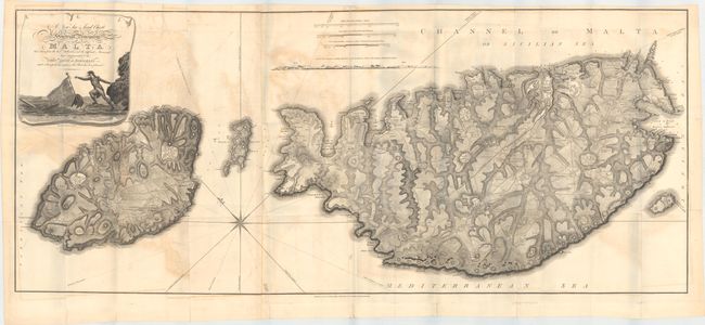
“A New Sea & Land Chart of the Sovereign Principality of Malta; Laid Down from the Best Authorities and the Different Manuscript Maps Communicated to the Chevr. Louis de Boisgelin...”
Map Maker:
Samuel John Neele
This rare, desirable and very detailed engraving d... (full text available to subscribers)
| Item Detail |
| |
| |
MapMaker: |
Samuel John Neele
|
|
| |
| |
Subject: |
Malta |
|
| |
Period/Size: |
1804 / 21.6" x 50.8" (54.9 x 129.1 cm)
|
|
| |
Color: |
Black & White
|
|
| |
Condition: |
(B) Issued folding with moderate offsetting and a few extraneous creases. There are several short splits at fold intersections and some small tears along the sheet edges confined to the blank margins, all of which have been closed on verso with archival (condition help) |
|
| |
Source: |
Ancient and Modern Malta… |
|
| |
References: |
|
|
| |
|
|
| Sales Information |
| |
| |
Price: |
|
|
| |
| |
Offered by: |
Old World Auctions |
|
| |
Catalog: |
Auction No. 149 - Antique Maps, Charts, Atlases & Globes (9228) |
|
| |
Lot/Item #: |
570 |
|
| |
| |
Date: |
05/2014
|
|
| |
| |
|
Antique Maps - Valuation and Pricing, Descriptions, Resources |
|
Home |
Information |
Search |
Register |
Contact Us |
Site Map
Americana Exchange, Inc. © 1999 - 2024 Americana Exchange, Inc.. All rights reserved.
OldMaps.com, the OldMaps.com logo and
AMPR are service marks or registered service marks of Americana Exchange, Inc..
|