Title:
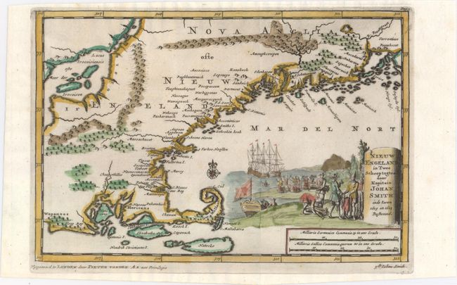
“Nieuw Engeland in Twee Scheeptogten door Kapitein Johan Smith inde Iaren 1614 en 1615 Bestevend”
Map Maker:
Pieter van der Aa
This interesting map covering Rhode Island to Peno... (full text available to subscribers)
| Item Detail |
| |
| |
MapMaker: |
Pieter van der Aa
|
|
| |
| |
Subject: |
Colonial New England - United States |
|
| |
Period/Size: |
1710 / 6.1" x 9.1" (15.5 x 23.2 cm)
|
|
| |
Color: |
Colored
|
|
| |
Condition: |
(A) Excellent impression and color with one small worm hole in left blank margin. (condition help) |
|
| |
Source: |
Naauwkeurige Versameling der Gedenk-Waardigste Zee en Landreysen… |
|
| |
References: |
McCorkle #707-2. |
|
| |
|
|
| Sales Information |
| |
| |
Price: |
|
|
| |
| |
Offered by: |
Old World Auctions |
|
| |
Catalog: |
Auction No. 150 - Antique Maps, Charts, Atlases & Globes (9230) |
|
| |
Lot/Item #: |
160 |
|
| |
| |
Date: |
09/2014
|
|
| |
| |
|
Antique Maps - Valuation and Pricing, Descriptions, Resources |
|
Home |
Information |
Search |
Register |
Contact Us |
Site Map
Americana Exchange, Inc. © 1999 - 2024 Americana Exchange, Inc.. All rights reserved.
OldMaps.com, the OldMaps.com logo and
AMPR are service marks or registered service marks of Americana Exchange, Inc..
|