Title:
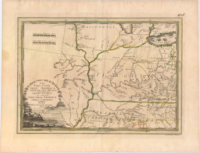
“Gli Stati Uniti dell'America Delineati sulle ultime Osservazioni - Terzo Foglio che comprende Parte Della Virginia e della Carolina”
Map Maker:
Giovanni Maria Cassini
This uncommon map is part of Cassini's six-sheet r... (full text available to subscribers)
| Item Detail |
| |
| |
MapMaker: |
Giovanni Maria Cassini
|
|
| |
| |
Subject: |
Central United States |
|
| |
Period/Size: |
1797 / 13.5" x 18.8" (34.3 x 47.8 cm)
|
|
| |
Color: |
Colored
|
|
| |
Condition: |
(B+) Lightly toned with original outline color. A professionally repaired tear enters the map just above the distance scales and is now nearly invisible. A manuscript ink page number is in the top right corner outside the neatline. (condition help) |
|
| |
Source: |
Nuovo Atlante Geografico Universale |
|
| |
References: |
Portinaro & Knirsch #166. |
|
| |
|
|
| Sales Information |
| |
| |
Price: |
|
|
| |
| |
Offered by: |
Old World Auctions |
|
| |
Catalog: |
Auction No. 150 - Antique Maps, Charts, Atlases & Globes (9230) |
|
| |
Lot/Item #: |
198 |
|
| |
| |
Date: |
09/2014
|
|
| |
| |
|
Antique Maps - Valuation and Pricing, Descriptions, Resources |
|
Home |
Information |
Search |
Register |
Contact Us |
Site Map
Americana Exchange, Inc. © 1999 - 2024 Americana Exchange, Inc.. All rights reserved.
OldMaps.com, the OldMaps.com logo and
AMPR are service marks or registered service marks of Americana Exchange, Inc..
|