Title:
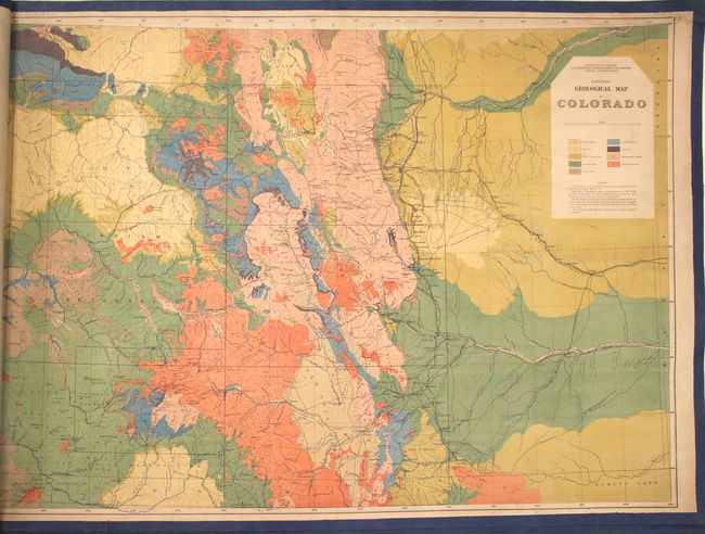
“Geological and Geographical Atlas of Colorado and Portions of Adjacent Territory”
Map Maker:
Ferdinand Vandeveer Hayden
According to Wheat, the 1877 atlas "was the highes... (full text available to subscribers)
| Item Detail |
| |
| |
MapMaker: |
Ferdinand Vandeveer Hayden
|
|
| |
| |
Subject: |
Colorado |
|
| |
Period/Size: |
1877 / 27.3" x 19.3" (69.4 x 49.1 cm)
|
|
| |
Color: |
Colored
|
|
| |
Condition: |
(B) All of the maps have been backed in linen with blue ribbon lining the sheet edges. A working example, the maps are held together by two wooden rods and metal bolts in the left blank margin of the sheets. The maps have minor to occasionally light soi (condition help) |
|
| |
Source: |
|
|
| |
References: |
Wheat (TMW) #1281. |
|
| |
|
|
| Sales Information |
| |
| |
Price: |
|
|
| |
| |
Offered by: |
Old World Auctions |
|
| |
Catalog: |
Auction No. 150 - Antique Maps, Charts, Atlases & Globes (9230) |
|
| |
Lot/Item #: |
223 |
|
| |
| |
Date: |
09/2014
|
|
| |
| |
|
Antique Maps - Valuation and Pricing, Descriptions, Resources |
|
Home |
Information |
Search |
Register |
Contact Us |
Site Map
Americana Exchange, Inc. © 1999 - 2024 Americana Exchange, Inc.. All rights reserved.
OldMaps.com, the OldMaps.com logo and
AMPR are service marks or registered service marks of Americana Exchange, Inc..
|