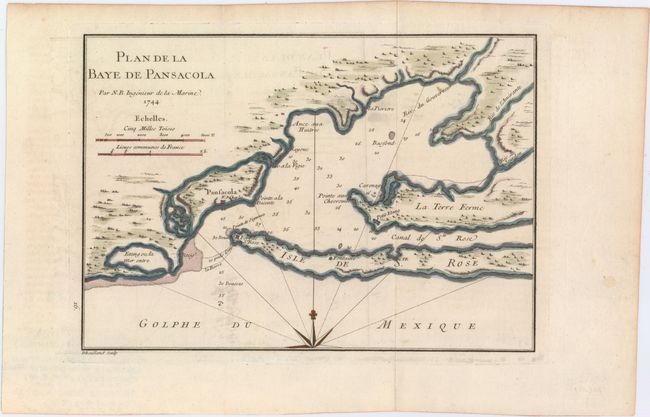
Title:
“Plan de la Baye de Pansacola”
Map Maker:
Jacques Nicolas Bellin
An early chart of Pensacola Harbor, showing the lo... (full text available to subscribers)
| Item Detail |
| |
| |
MapMaker: |
Jacques Nicolas Bellin
|
|
| |
| |
Subject: |
Pensacola, Florida |
|
| |
Period/Size: |
1744 / 7.8" x 11.1" (19.9 x 28.2 cm)
|
|
| |
Color: |
Colored
|
|
| |
Condition: |
(B+) Issued folding on watermarked paper with light offsetting and minor soiling. (condition help) |
|
| |
Source: |
Histoire et Description Generale de la Nouvelle France |
|
| |
References: |
Tooley (MCC-96) #720. |
|
| |
|
|
| Sales Information |
| |
| |
Price: |
|
|
| |
| |
Offered by: |
Old World Auctions |
|
| |
Catalog: |
Auction No. 150 - Antique Maps, Charts, Atlases & Globes (9230) |
|
| |
Lot/Item #: |
231 |
|
| |
| |
Date: |
09/2014
|
|
| |
| |
|
Antique Maps - Valuation and Pricing, Descriptions, Resources |
|
Home |
Information |
Search |
Register |
Contact Us |
Site Map
Americana Exchange, Inc. © 1999 - 2024 Americana Exchange, Inc.. All rights reserved.
OldMaps.com, the OldMaps.com logo and
AMPR are service marks or registered service marks of Americana Exchange, Inc..
|