Title:
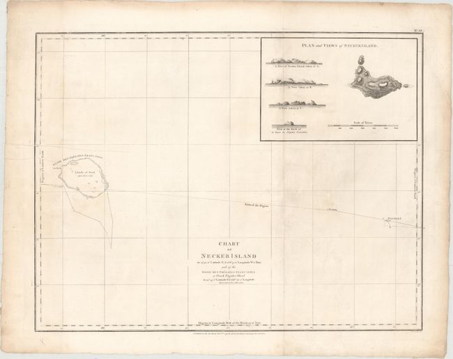
“Chart of Necker Island ... and of the Basse des Fregates Francaises of French Frigates Shoal...”
Map Maker:
Jean Francois Galaup de La Perouse
This chart focuses on Jean-Francois de la Perouse'... (full text available to subscribers)
| Item Detail |
| |
| |
MapMaker: |
Jean Francois Galaup de La Perouse
|
|
| |
| |
Subject: |
Northwestern Hawaiian Islands |
|
| |
Period/Size: |
1798 / 15.1" x 19.4" (38.4 x 49.3 cm)
|
|
| |
Color: |
Black & White
|
|
| |
Condition: |
(B+) On a watermarked sheet with a very faint damp stain and minor soiling. (condition help) |
|
| |
Source: |
Charts And Plates To La Perouse's Voyage... |
|
| |
References: |
Fitzgerald pp.29-31; cf. Shirley (BL Atlases) G.LPR-2a. |
|
| |
|
|
| Sales Information |
| |
| |
Price: |
|
|
| |
| |
Offered by: |
Old World Auctions |
|
| |
Catalog: |
Auction No. 150 - Antique Maps, Charts, Atlases & Globes (9230) |
|
| |
Lot/Item #: |
233 |
|
| |
| |
Date: |
09/2014
|
|
| |
| |
|
Antique Maps - Valuation and Pricing, Descriptions, Resources |
|
Home |
Information |
Search |
Register |
Contact Us |
Site Map
Americana Exchange, Inc. © 1999 - 2024 Americana Exchange, Inc.. All rights reserved.
OldMaps.com, the OldMaps.com logo and
AMPR are service marks or registered service marks of Americana Exchange, Inc..
|