| Item Detail |
| |
| |
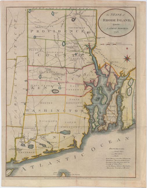
MapMaker: |
John Reid
|
|
| |
| |
Subject: |
Rhode Island |
|
| |
Period/Size: |
1796 / 17.0" x 12.9" (43.2 x 32.8 cm)
|
|
| |
Color: |
Colored
|
|
| |
Condition: |
(B+) Issued folding, now pressed, with light soiling, a hint of offsetting, and archival repairs to a few tiny fold separations. (condition help) |
|
| |
Source: |
Winterbotham's America |
|
| |
References: |
Phillips (A) #1216-8; Wheat & Brun #254. |
|
| |
|
|
| Sales Information |
| |
| |
Price: |
|
|
| |
| |
Offered by: |
Old World Auctions |
|
| |
Catalog: |
Auction No. 150 - Antique Maps, Charts, Atlases & Globes (9230) |
|
| |
Lot/Item #: |
279 |
|
| |
| |
Date: |
09/2014
|
|
| |
| |
|