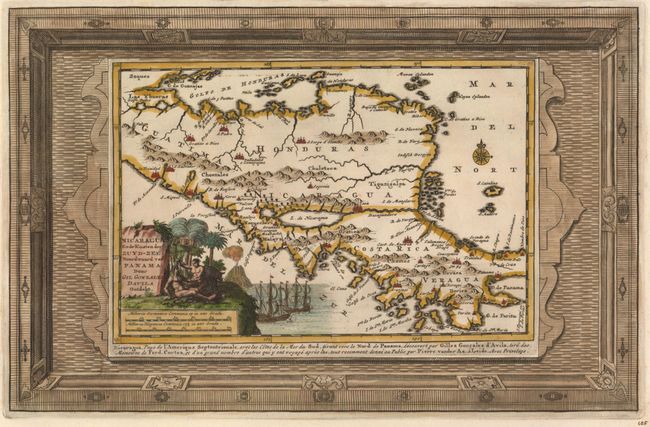
Title:
“Nicaragua ende Kusten der Zuyd-Zee, Noordwaard van Panama, door Gil Gonzales Davila Ontdekt”
Map Maker:
Pieter van der Aa
This map of Nicaragua, Honduras and Costa Rica ill... (full text available to subscribers)
| Item Detail |
| |
| |
MapMaker: |
Pieter van der Aa
|
|
| |
| |
Subject: |
Nicaragua, Honduras, and Costa Rica |
|
| |
Period/Size: |
1729 / 8.6" x 13.3" (21.9 x 33.8 cm)
|
|
| |
Color: |
Colored
|
|
| |
Condition: |
(A) Fine impression and color on watermarked paper with wide margins. (condition help) |
|
| |
Source: |
La Galerie Agreable du Monde |
|
| |
References: |
Shirley (BL Atlases) T.AA-5a. |
|
| |
|
|
| Sales Information |
| |
| |
Price: |
|
|
| |
| |
Offered by: |
Old World Auctions |
|
| |
Catalog: |
Auction No. 150 - Antique Maps, Charts, Atlases & Globes (9230) |
|
| |
Lot/Item #: |
322 |
|
| |
| |
Date: |
09/2014
|
|
| |
| |
|
Antique Maps - Valuation and Pricing, Descriptions, Resources |
|
Home |
Information |
Search |
Register |
Contact Us |
Site Map
Americana Exchange, Inc. © 1999 - 2024 Americana Exchange, Inc.. All rights reserved.
OldMaps.com, the OldMaps.com logo and
AMPR are service marks or registered service marks of Americana Exchange, Inc..
|