Title:
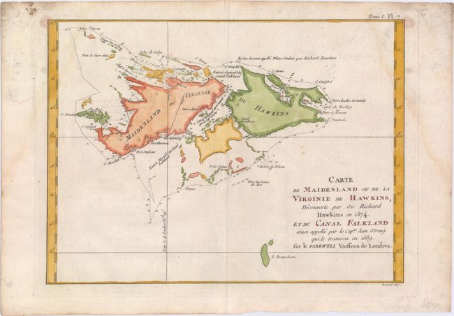
“Carte de Maidenland ou de la Virginie de Hawkins, Decouverte par Sir Richard Hawkins en 1574, et du Canal Falkland ainsi Appelle par le Capne. Jean Strong qui le Traversa en 1689. Sur le Farewell Vaisseau de Londres”
Map Maker:
Robert Benard
This striking chart of the Falkland Islands shows ... (full text available to subscribers)
| Item Detail |
| |
| |
MapMaker: |
Robert Benard
|
|
| |
| |
Subject: |
Falkland Islands |
|
| |
Period/Size: |
1760 / 8.7" x 11.8" (22.1 x 30.0 cm)
|
|
| |
Color: |
Colored
|
|
| |
Condition: |
(B+) On watermarked paper with faint damp stains that enter the map in the top corners and minor offsetting. (condition help) |
|
| |
Source: |
|
|
| |
References: |
|
|
| |
|
|
| Sales Information |
| |
| |
Price: |
|
|
| |
| |
Offered by: |
Old World Auctions |
|
| |
Catalog: |
Auction No. 150 - Antique Maps, Charts, Atlases & Globes (9230) |
|
| |
Lot/Item #: |
390 |
|
| |
| |
Date: |
09/2014
|
|
| |
| |
|
Antique Maps - Valuation and Pricing, Descriptions, Resources |
|
Home |
Information |
Search |
Register |
Contact Us |
Site Map
Americana Exchange, Inc. © 1999 - 2024 Americana Exchange, Inc.. All rights reserved.
OldMaps.com, the OldMaps.com logo and
AMPR are service marks or registered service marks of Americana Exchange, Inc..
|