| Item Detail |
| |
| |
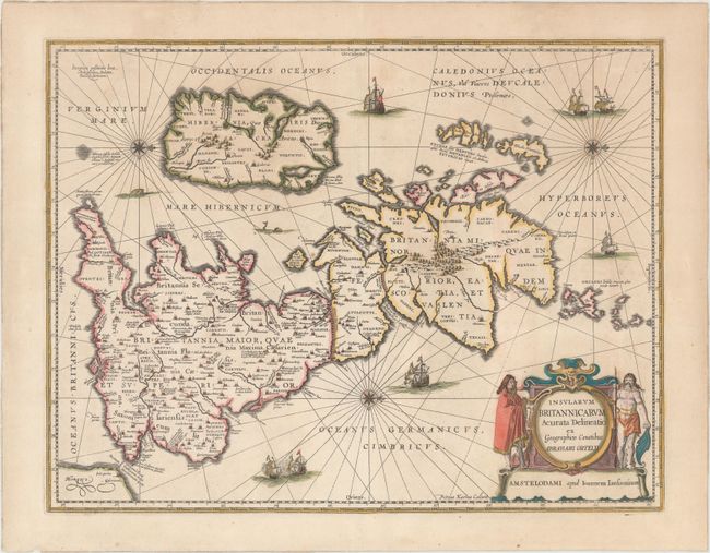
MapMaker: |
Jan Jansson
|
|
| |
| |
Subject: |
Britain |
|
| |
Period/Size: |
1650 / 15.5" x 20.1" (39.4 x 51.1 cm)
|
|
| |
Color: |
Colored
|
|
| |
Condition: |
(A+) A lovely old colored example on a clean, bright sheet with excellent margins and very minor retouching of color. (condition help) |
|
| |
Source: |
|
|
| |
References: |
Shirley (BI to 1650) #466; Van der Krogt (Vol. I) #5000H:1A; Phillips (A) #3427. |
|
| |
|
|
| Sales Information |
| |
| |
Price: |
|
|
| |
| |
Offered by: |
Old World Auctions |
|
| |
Catalog: |
Auction No. 150 - Antique Maps, Charts, Atlases & Globes (9230) |
|
| |
Lot/Item #: |
410 |
|
| |
| |
Date: |
09/2014
|
|
| |
| |
|