| Item Detail |
| |
| |
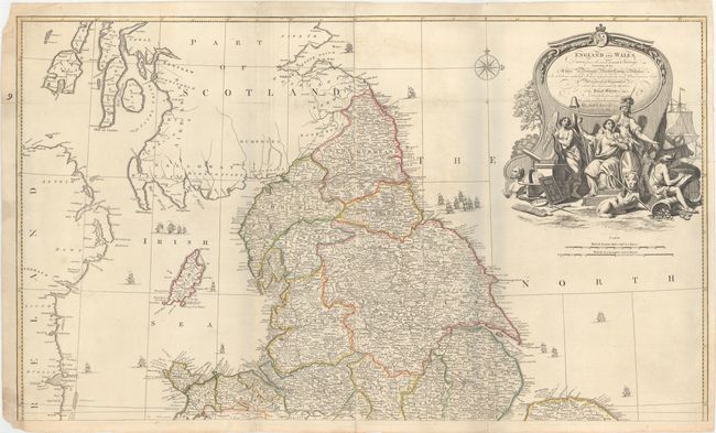
MapMaker: |
John Rocque
|
|
| |
| |
Subject: |
England & Wales |
|
| |
Period/Size: |
1761 / 23.0" x 38.9" (58.5 x 98.8 cm)
|
|
| |
Color: |
Colored
|
|
| |
Condition: |
(B+) A nice impression with attractive color and minor soiling. There are a few short fold separations and edge tears that enter about 1" to 2" into map that have been closed on verso with archival material. There are pale blue shadows along the folds w (condition help) |
|
| |
Source: |
General Atlas |
|
| |
References: |
|
|
| |
|
|
| Sales Information |
| |
| |
Price: |
|
|
| |
| |
Offered by: |
Old World Auctions |
|
| |
Catalog: |
Auction No. 150 - Antique Maps, Charts, Atlases & Globes (9230) |
|
| |
Lot/Item #: |
426 |
|
| |
| |
Date: |
09/2014
|
|
| |
| |
|