Title:
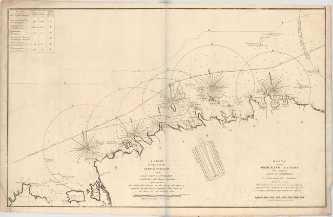
“A Chart of a Part of the Gulf of Finland from Island Dago to Stoneskar & with the Light Houses Marked...”
Map Maker:
Leonti Vasilevich Spafarev
This large, uncommon chart of a stretch of Estonia... (full text available to subscribers)
| Item Detail |
| |
| |
MapMaker: |
Leonti Vasilevich Spafarev
|
|
| |
| |
Subject: |
Estonia, Gulf of Finland |
|
| |
Period/Size: |
1817 / 23.0" x 36.5" (58.5 x 92.8 cm)
|
|
| |
Color: |
Black & White
|
|
| |
Condition: |
(B) On watermarked paper (dated 1813) with moderate offsetting and minor soiling especially concentrated around the corners of the sheet. The bluish line that appears in the image is caused by the scanner and not on the actual map. (condition help) |
|
| |
Source: |
Atlas of the Gulf of Finland containing the South Coast... |
|
| |
References: |
|
|
| |
|
|
| Sales Information |
| |
| |
Price: |
|
|
| |
| |
Offered by: |
Old World Auctions |
|
| |
Catalog: |
Auction No. 150 - Antique Maps, Charts, Atlases & Globes (9230) |
|
| |
Lot/Item #: |
448 |
|
| |
| |
Date: |
09/2014
|
|
| |
| |
|
Antique Maps - Valuation and Pricing, Descriptions, Resources |
|
Home |
Information |
Search |
Register |
Contact Us |
Site Map
Americana Exchange, Inc. © 1999 - 2024 Americana Exchange, Inc.. All rights reserved.
OldMaps.com, the OldMaps.com logo and
AMPR are service marks or registered service marks of Americana Exchange, Inc..
|