| Item Detail |
| |
| |
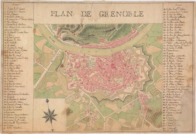
MapMaker: |
Manuscript Maps
|
|
| |
| |
Subject: |
Grenoble, France |
|
| |
Period/Size: |
1750 / 11.0" x 16.3" (28.0 x 41.4 cm)
|
|
| |
Color: |
Colored
|
|
| |
Condition: |
(B) On hand-laid paper with the watermark of "Fin de M [fleur-de-lis] Iohannot d'Annonay 1749." There is moderate soiling, and several short edge tears have been archivally repaired. A large chip at bottom left has been professionally repaired with old (condition help) |
|
| |
Source: |
|
|
| |
References: |
|
|
| |
|
|
| Sales Information |
| |
| |
Price: |
|
|
| |
| |
Offered by: |
Old World Auctions |
|
| |
Catalog: |
Auction No. 150 - Antique Maps, Charts, Atlases & Globes (9230) |
|
| |
Lot/Item #: |
470 |
|
| |
| |
Date: |
09/2014
|
|
| |
| |
|