Title:
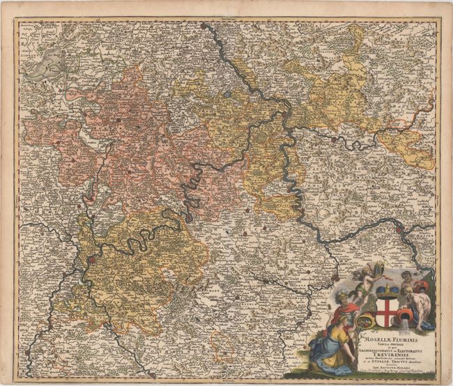
“Mosellae Fluminis Tabula Specialis in qua Archiepiscopatus et Electoratus Trevirensis...”
Map Maker:
Johann Baptist Homann
This detailed map of the western part of Rheinland... (full text available to subscribers)
| Item Detail |
| |
| |
MapMaker: |
Johann Baptist Homann
|
|
| |
| |
Subject: |
Western Germany |
|
| |
Period/Size: |
1716 / 19.3" x 22.5" (49.1 x 57.2 cm)
|
|
| |
Color: |
Colored
|
|
| |
Condition: |
(B+) On watermarked paper that has been trimmed to the neatline at bottom, as issued. There are a few short edge tears and tiny worm holes in the top blank margin. (condition help) |
|
| |
Source: |
Grosser Atlas |
|
| |
References: |
|
|
| |
|
|
| Sales Information |
| |
| |
Price: |
|
|
| |
| |
Offered by: |
Old World Auctions |
|
| |
Catalog: |
Auction No. 150 - Antique Maps, Charts, Atlases & Globes (9230) |
|
| |
Lot/Item #: |
487 |
|
| |
| |
Date: |
09/2014
|
|
| |
| |
|
Antique Maps - Valuation and Pricing, Descriptions, Resources |
|
Home |
Information |
Search |
Register |
Contact Us |
Site Map
Americana Exchange, Inc. © 1999 - 2024 Americana Exchange, Inc.. All rights reserved.
OldMaps.com, the OldMaps.com logo and
AMPR are service marks or registered service marks of Americana Exchange, Inc..
|