Title:
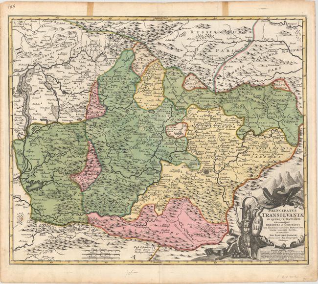
“Principatus Transilvaniae in Quinque Nationes Earumque Regiones et Comitatus cum Finitimis Vicinorum Statuum Provinciis Accurate Divisus, ex Conatibus”
Map Maker:
Johann Baptist Homann
This handsome map of the Transylvania region of Ro... (full text available to subscribers)
| Item Detail |
| |
| |
MapMaker: |
Johann Baptist Homann
|
|
| |
| |
Subject: |
Romania |
|
| |
Period/Size: |
1720 / 18.8" x 22.8" (47.8 x 58.0 cm)
|
|
| |
Color: |
Colored
|
|
| |
Condition: |
(B+) A nice impression on watermarked paper with original color and some small light spots. A tear that extends 2" into map at top has been closed on verso with archival tape, and two tears that touch the neatline have been closed on recto with cello tap (condition help) |
|
| |
Source: |
|
|
| |
References: |
|
|
| |
|
|
| Sales Information |
| |
| |
Price: |
|
|
| |
| |
Offered by: |
Old World Auctions |
|
| |
Catalog: |
Auction No. 150 - Antique Maps, Charts, Atlases & Globes (9230) |
|
| |
Lot/Item #: |
522 |
|
| |
| |
Date: |
09/2014
|
|
| |
| |
|
Antique Maps - Valuation and Pricing, Descriptions, Resources |
|
Home |
Information |
Search |
Register |
Contact Us |
Site Map
Americana Exchange, Inc. © 1999 - 2024 Americana Exchange, Inc.. All rights reserved.
OldMaps.com, the OldMaps.com logo and
AMPR are service marks or registered service marks of Americana Exchange, Inc..
|