| Item Detail |
| |
| |
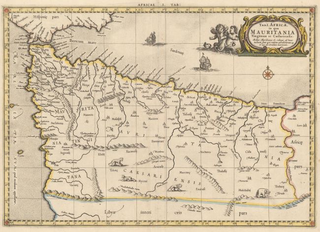
MapMaker: |
Ptolemy/Mercator
|
|
| |
| |
Subject: |
Northwestern Africa |
|
| |
Period/Size: |
1730 / 12.8" x 18.1" (32.6 x 46.0 cm)
|
|
| |
Color: |
Colored
|
|
| |
Condition: |
(A) A fine impression with attractive color, wide margins, and a minor crease adjacent to centerfold. There is a damp stain on the bottom edge of the sheet, far from map image. (condition help) |
|
| |
Source: |
Claudii Ptolemaei's Atlas Tabulae Geographicae Orbis Terrarum |
|
| |
References: |
Mickwitz & Miekkavaara #235-2; Van der Krogt (Vol. I) #0911:1.3. |
|
| |
|
|
| Sales Information |
| |
| |
Price: |
|
|
| |
| |
Offered by: |
Old World Auctions |
|
| |
Catalog: |
Auction No. 150 - Antique Maps, Charts, Atlases & Globes (9230) |
|
| |
Lot/Item #: |
677 |
|
| |
| |
Date: |
09/2014
|
|
| |
| |
|