Title:
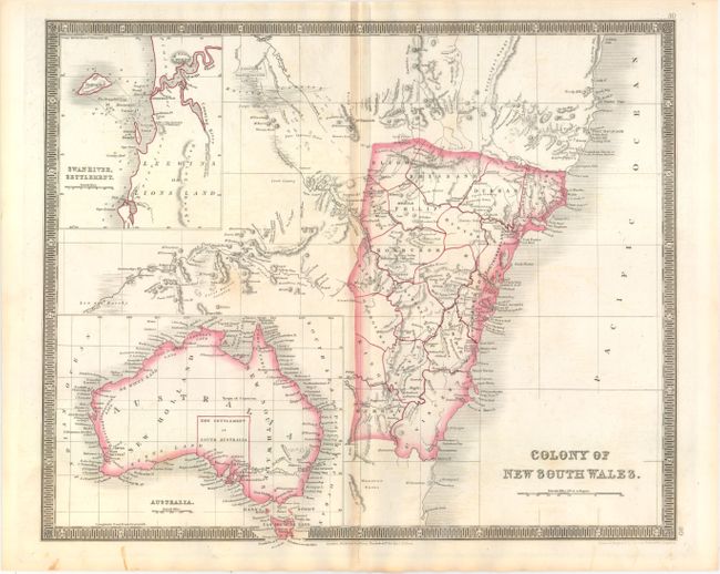
“Colony of New South Wales”
Map Maker:
Henry Teesdale [& Co.]
This detailed map of New South Wales is divided in... (full text available to subscribers)
| Item Detail |
| |
| |
MapMaker: |
Henry Teesdale [& Co.]
|
|
| |
| |
Subject: |
Australia |
|
| |
Period/Size: |
1837 / 13.4" x 16.2" (34.1 x 41.2 cm)
|
|
| |
Color: |
Colored
|
|
| |
Condition: |
(B+) Original color on watermarked paper (J. Whatman 1837) with light toning along the centerfold. (condition help) |
|
| |
Source: |
A New General Atlas of the World |
|
| |
References: |
Tooley (Australia) #457. |
|
| |
|
|
| Sales Information |
| |
| |
Price: |
|
|
| |
| |
Offered by: |
Old World Auctions |
|
| |
Catalog: |
Auction No. 150 - Antique Maps, Charts, Atlases & Globes (9230) |
|
| |
Lot/Item #: |
711 |
|
| |
| |
Date: |
09/2014
|
|
| |
| |
|
Antique Maps - Valuation and Pricing, Descriptions, Resources |
|
Home |
Information |
Search |
Register |
Contact Us |
Site Map
Americana Exchange, Inc. © 1999 - 2024 Americana Exchange, Inc.. All rights reserved.
OldMaps.com, the OldMaps.com logo and
AMPR are service marks or registered service marks of Americana Exchange, Inc..
|