| Item Detail |
| |
| |
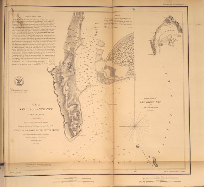
MapMaker: |
U.S. Coast Survey
|
|
| |
| |
Subject: |
Exploration and Surveys |
|
| |
Period/Size: |
1854 / 11.7" x 9.5" (29.8 x 24.2 cm)
|
|
| |
Color: |
Black & White
|
|
| |
Condition: |
(B+) Maps are good to very good with some occasional toning. Map no. 1 (Nantucket region) has a 7.5" binding tear and map no. 6 (Long Island region) has a 2.5" binding tear. Text has light scattered foxing which is more prevalent in the first half of th (condition help) |
|
| |
Source: |
Sen. Ex. Doc. No. 14, 33rd Cong., 1st Sess. |
|
| |
References: |
|
|
| |
|
|
| Sales Information |
| |
| |
Price: |
|
|
| |
| |
Offered by: |
Old World Auctions |
|
| |
Catalog: |
Auction No. 150 - Antique Maps, Charts, Atlases & Globes (9230) |
|
| |
Lot/Item #: |
761 |
|
| |
| |
Date: |
09/2014
|
|
| |
| |
|