| Item Detail |
| |
| |
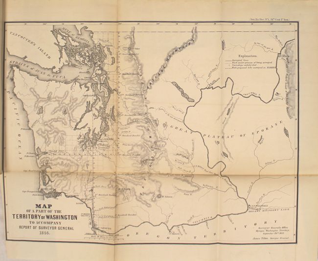
MapMaker: |
U.S. Government
|
|
| |
| |
Subject: |
Exploration and Surveys |
|
| |
Period/Size: |
1856 / 11.9" x 8.8" (30.3 x 22.4 cm)
|
|
| |
Color: |
Black & White
|
|
| |
Condition: |
(B) Overall the maps are in good to very good condition in a few cases with light toning and occasional damp staining mainly along the folds. The map of California has an 8" binding tear and one tiny area of loss at a fold intersection. The map of Flori (condition help) |
|
| |
Source: |
Sen Ex. Doc. 1, 34th Cong., 1st Sess. |
|
| |
References: |
|
|
| |
|
|
| Sales Information |
| |
| |
Price: |
|
|
| |
| |
Offered by: |
Old World Auctions |
|
| |
Catalog: |
Auction No. 150 - Antique Maps, Charts, Atlases & Globes (9230) |
|
| |
Lot/Item #: |
762 |
|
| |
| |
Date: |
09/2014
|
|
| |
| |
|