Rister or Sign In to see pricing information


Title:

The Isle of California. New Mexico. Louisiane. The River Misisipi. And the Lake's of Canada.

Map Maker:

Herman Moll

The Isle of California. New Mexico. Louisiane. The River Misisipi. And the Lake's of Canada.

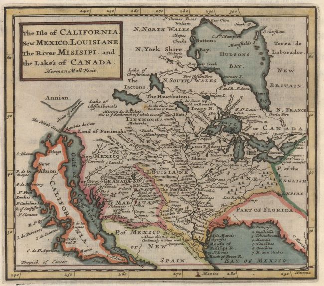
Herman Moll's map of the island of California
Item Detail
 
  MapMaker:  

Herman Moll


  Subject:  Western North America, California  
  Period/Size:  1701 / 6.4" x 7.3"  (16.3 x 18.6 cm)  
  Color:  Colored  
  Condition:  (A) A fine, dark impression with one small spot. (condition help)  
  Source:  A System of Geography...  
  References:  McLaughlin #144; Tooley (Amer) p.129 #78; Wagner (NW) #487; Wheat (TMW) #81 & #109.  
 
 
Sales Information
 
  Price: 

Please register your email to view records, or sign in with email address to see records


  Offered by:  Old World Auctions  
  Catalog:  Auction No. 151 - Antique Maps, Charts, Atlases & Globes (9260)  
  Lot/Item #:  91  
 
  Date:  11/2014  


Antique Maps - Valuation and Pricing, Descriptions, Resources


Home | Information | Search | Register | Contact Us | Site Map

Americana Exchange, Inc. © 1999 - 2024 Americana Exchange, Inc.. All rights reserved. OldMaps.com, the OldMaps.com logo and
AMPR are service marks or registered service marks of Americana Exchange, Inc..