| Item Detail |
| |
| |
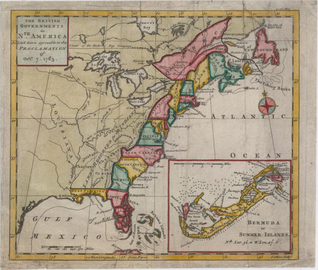
MapMaker: |
John Gibson
|
|
| |
| |
Subject: |
Colonial Eastern United States & Canada |
|
| |
Period/Size: |
1763 / 8.0" x 9.2" (20.4 x 23.4 cm)
|
|
| |
Color: |
Colored
|
|
| |
Condition: |
(B) Originally issued folding, now flat, with light soiling, a few short archivally repaired tears and fold separations, and some tiny worm holes that are only visible when held up to light. (condition help) |
|
| |
Source: |
Gentleman's Magazine |
|
| |
References: |
Fite & Freeman #55; Jolly #GENT-170; McCorkle #763.3; Sellers & Van Ee #110. |
|
| |
|
|
| Sales Information |
| |
| |
Price: |
|
|
| |
| |
Offered by: |
Old World Auctions |
|
| |
Catalog: |
Auction No. 151 - Antique Maps, Charts, Atlases & Globes (9260) |
|
| |
Lot/Item #: |
114 |
|
| |
| |
Date: |
11/2014
|
|
| |
| |
|