Title:
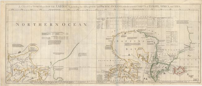
“A Chart of North and South America, Including the Atlantic and Pacific Oceans, with the Nearest Coasts of Europe, Africa, and Asia”
Map Maker:
Jefferys/Sayer & Bennett
This is the top portion of Thomas Jefferys' large ... (full text available to subscribers)
| Item Detail |
| |
| |
MapMaker: |
Jefferys/Sayer & Bennett
|
|
| |
| |
Subject: |
Colonial Canada & Alaska |
|
| |
Period/Size: |
1775 / 17.9" x 43.6" (45.5 x 110.8 cm)
|
|
| |
Color: |
Colored
|
|
| |
Condition: |
(B+) A nice impression on watermarked paper with light soiling. There are professional repairs to two tears that enter 1" to 2" into map at top left and two fold separations confined to the top blank margin. The bluish shadow on the scanned image is a re (condition help) |
|
| |
Source: |
The American Atlas |
|
| |
References: |
Kershaw #450; Ristow pp. 31-32; Stevens & Tree #4d; Wagner (NW) #578 & p. 160 (1st ed.). |
|
| |
|
|
| Sales Information |
| |
| |
Price: |
|
|
| |
| |
Offered by: |
Old World Auctions |
|
| |
Catalog: |
Auction No. 151 - Antique Maps, Charts, Atlases & Globes (9260) |
|
| |
Lot/Item #: |
122 |
|
| |
| |
Date: |
11/2014
|
|
| |
| |
|
Antique Maps - Valuation and Pricing, Descriptions, Resources |
|
Home |
Information |
Search |
Register |
Contact Us |
Site Map
Americana Exchange, Inc. © 1999 - 2024 Americana Exchange, Inc.. All rights reserved.
OldMaps.com, the OldMaps.com logo and
AMPR are service marks or registered service marks of Americana Exchange, Inc..
|