Title:
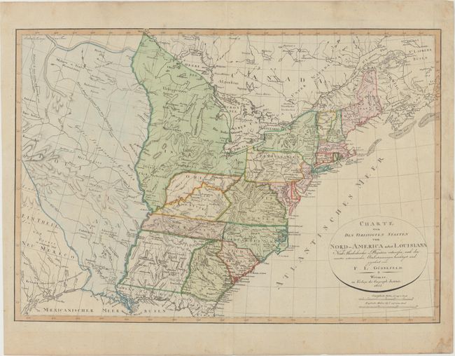
“Charte von den Vereinigten Staaten von Nord-America nebst Louisiana...”
Map Maker:
Weimar Geographisches Institut
This uncommon map depicts the United States in the... (full text available to subscribers)
| Item Detail |
| |
| |
MapMaker: |
Weimar Geographisches Institut
|
|
| |
| |
Subject: |
Eastern United States |
|
| |
Period/Size: |
1805 / 18.6" x 26.9" (47.3 x 68.4 cm)
|
|
| |
Color: |
Colored
|
|
| |
Condition: |
(A) On watermarked paper with light creasing at right and minor soiling primarily confined to the blank margins. (condition help) |
|
| |
Source: |
|
|
| |
References: |
|
|
| |
|
|
| Sales Information |
| |
| |
Price: |
|
|
| |
| |
Offered by: |
Old World Auctions |
|
| |
Catalog: |
Auction No. 151 - Antique Maps, Charts, Atlases & Globes (9260) |
|
| |
Lot/Item #: |
142 |
|
| |
| |
Date: |
11/2014
|
|
| |
| |
|
Antique Maps - Valuation and Pricing, Descriptions, Resources |
|
Home |
Information |
Search |
Register |
Contact Us |
Site Map
Americana Exchange, Inc. © 1999 - 2024 Americana Exchange, Inc.. All rights reserved.
OldMaps.com, the OldMaps.com logo and
AMPR are service marks or registered service marks of Americana Exchange, Inc..
|