| Item Detail |
| |
| |
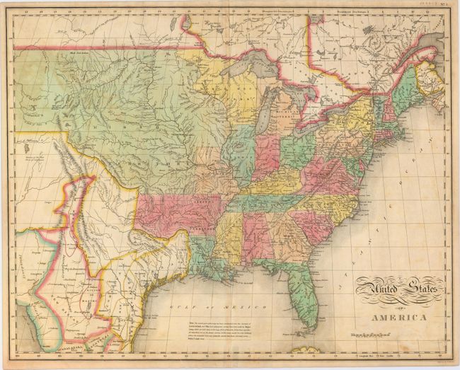
MapMaker: |
John Melish
|
|
| |
| |
Subject: |
Eastern United States |
|
| |
Period/Size: |
1827 / 17.0" x 21.4" (43.2 x 54.4 cm)
|
|
| |
Color: |
Colored
|
|
| |
Condition: |
(B+) A nice impression with minor uneven toning, light soiling, and an edge tear at bottom that just touches the neatline and has been closed on verso with archival tape. A small piece of cello tape is located along the bottom centerfold on verso creatin (condition help) |
|
| |
Source: |
Carey & Lea's American Atlas |
|
| |
References: |
cf. Wheat [TMW] #338; Phillips (A) #1177. |
|
| |
|
|
| Sales Information |
| |
| |
Price: |
|
|
| |
| |
Offered by: |
Old World Auctions |
|
| |
Catalog: |
Auction No. 151 - Antique Maps, Charts, Atlases & Globes (9260) |
|
| |
Lot/Item #: |
144 |
|
| |
| |
Date: |
11/2014
|
|
| |
| |
|