| Item Detail |
| |
| |
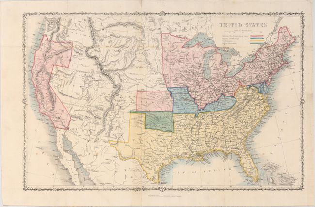
MapMaker: |
London Printing & Publishing
|
|
| |
| |
Subject: |
United States, Civil War |
|
| |
Period/Size: |
1861 / 10.8" x 16.9" (27.5 x 43.0 cm)
|
|
| |
Color: |
Colored
|
|
| |
Condition: |
(B+) Issued folding with a few spots of foxing, minor toning, and a short binding tear that just passes the neatline at right closed on verso with archival tape. (condition help) |
|
| |
Source: |
|
|
| |
References: |
|
|
| |
|
|
| Sales Information |
| |
| |
Price: |
|
|
| |
| |
Offered by: |
Old World Auctions |
|
| |
Catalog: |
Auction No. 151 - Antique Maps, Charts, Atlases & Globes (9260) |
|
| |
Lot/Item #: |
132 |
|
| |
| |
Date: |
11/2014
|
|
| |
| |
|