Title:
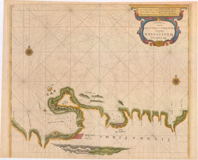
“De Cust van Westindien, Tusschen Punta St. Blaes, en Punta d Naes”
Map Maker:
Roggeveen [Family]
This rare chart focuses on the coastline between P... (full text available to subscribers)
| Item Detail |
| |
| |
MapMaker: |
Roggeveen [Family]
|
|
| |
| |
Subject: |
Panama |
|
| |
Period/Size: |
1675 / 16.8" x 19.8" (42.7 x 50.3 cm)
|
|
| |
Color: |
Colored
|
|
| |
Condition: |
(A) Watermarked paper with a narrow top margin, as issued. (condition help) |
|
| |
Source: |
Het Eerste Deel Van het Brandende Veen… |
|
| |
References: |
Kapp (MCC-73) #16; Shirley (BL Atlases) #M.ROG-1b. |
|
| |
|
|
| Sales Information |
| |
| |
Price: |
|
|
| |
| |
Offered by: |
Old World Auctions |
|
| |
Catalog: |
Auction No. 151 - Antique Maps, Charts, Atlases & Globes (9260) |
|
| |
Lot/Item #: |
349 |
|
| |
| |
Date: |
11/2014
|
|
| |
| |
|
Antique Maps - Valuation and Pricing, Descriptions, Resources |
|
Home |
Information |
Search |
Register |
Contact Us |
Site Map
Americana Exchange, Inc. © 1999 - 2024 Americana Exchange, Inc.. All rights reserved.
OldMaps.com, the OldMaps.com logo and
AMPR are service marks or registered service marks of Americana Exchange, Inc..
|