| Item Detail |
| |
| |
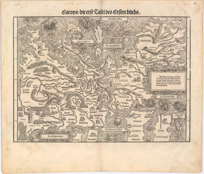
MapMaker: |
Johannes Stumpf
|
|
| |
| |
Subject: |
Europe |
|
| |
Period/Size: |
1548 / 11.0" x 15.4" (28.0 x 39.2 cm)
|
|
| |
Color: |
Black & White
|
|
| |
Condition: |
(B+) An excellent impression with original margins, light toning along the centerfold, and a few small spots of foxing. There is marginal soiling and an archivally repaired centerfold separation in the bottom blank margin, far from map. (condition help) |
|
| |
Source: |
Gemeiner Loblicher Eydgnoschafft Stetten Landen und Volkeren Chronick |
|
| |
References: |
Mickwitz & Miekkavaara #289-1; Heijden #11. |
|
| |
|
|
| Sales Information |
| |
| |
Price: |
|
|
| |
| |
Offered by: |
Old World Auctions |
|
| |
Catalog: |
Auction No. 151 - Antique Maps, Charts, Atlases & Globes (9260) |
|
| |
Lot/Item #: |
444 |
|
| |
| |
Date: |
11/2014
|
|
| |
| |
|