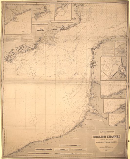
Title:
“Eastern Portion of the English Channel Compiled from Recent English and French Surveys”
Map Maker:
James Imray, Sr.
This sizable blue-backed sea chart is on two joine... (full text available to subscribers)
| Item Detail |
| |
| |
MapMaker: |
James Imray, Sr.
|
|
| |
| |
Subject: |
English Channel |
|
| |
Period/Size: |
1890 / 50.3" x 40.0" (127.8 x 101.6 cm)
|
|
| |
Color: |
Black & White
|
|
| |
Condition: |
(B+) A dark impression with original color (red and yellow) on lighthouses. There is light soiling and toning as well as some damp stains at the edges of the image. A few notations appear in pencil. (condition help) |
|
| |
Source: |
|
|
| |
References: |
|
|
| |
|
|
| Sales Information |
| |
| |
Price: |
|
|
| |
| |
Offered by: |
Old World Auctions |
|
| |
Catalog: |
Auction No. 151 - Antique Maps, Charts, Atlases & Globes (9260) |
|
| |
Lot/Item #: |
462 |
|
| |
| |
Date: |
11/2014
|
|
| |
| |
|
Antique Maps - Valuation and Pricing, Descriptions, Resources |
|
Home |
Information |
Search |
Register |
Contact Us |
Site Map
Americana Exchange, Inc. © 1999 - 2024 Americana Exchange, Inc.. All rights reserved.
OldMaps.com, the OldMaps.com logo and
AMPR are service marks or registered service marks of Americana Exchange, Inc..
|