Title:
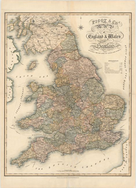
“Pigot & Co.'s New Map of England &Wales. With Part of Scotland. Including the New Lines of Canals, Rail Roads &c.”
Map Maker:
James Pigot [& Co.]
This large, detailed steel-engraved map of England... (full text available to subscribers)
| Item Detail |
| |
| |
MapMaker: |
James Pigot [& Co.]
|
|
| |
| |
Subject: |
England & Wales |
|
| |
Period/Size: |
1838 / 26.7" x 20.8" (67.9 x 52.9 cm)
|
|
| |
Color: |
Colored
|
|
| |
Condition: |
(B) Two folds as issued with a number of fold separations and edge tears, all of which have been archivally repaired. There are also areas of light toning, especially concentrated around the sheet's vertical fold. (condition help) |
|
| |
Source: |
|
|
| |
References: |
|
|
| |
|
|
| Sales Information |
| |
| |
Price: |
|
|
| |
| |
Offered by: |
Old World Auctions |
|
| |
Catalog: |
Auction No. 151 - Antique Maps, Charts, Atlases & Globes (9260) |
|
| |
Lot/Item #: |
467 |
|
| |
| |
Date: |
11/2014
|
|
| |
| |
|
Antique Maps - Valuation and Pricing, Descriptions, Resources |
|
Home |
Information |
Search |
Register |
Contact Us |
Site Map
Americana Exchange, Inc. © 1999 - 2024 Americana Exchange, Inc.. All rights reserved.
OldMaps.com, the OldMaps.com logo and
AMPR are service marks or registered service marks of Americana Exchange, Inc..
|