| Item Detail |
| |
| |
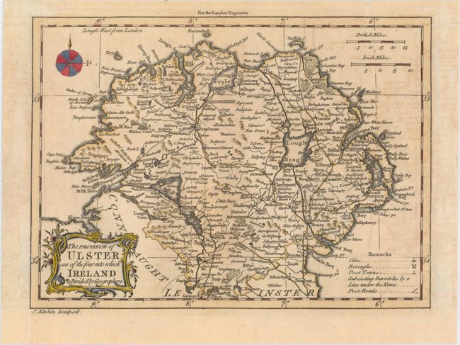
MapMaker: |
Thomas Kitchin
|
|
| |
| |
Subject: |
Northern Ireland |
|
| |
Period/Size: |
1766 / 6.7" x 9.1" (17.1 x 23.2 cm)
|
|
| |
Color: |
Colored
|
|
| |
Condition: |
(B+) A nice impression, issued folding on a slightly toned sheet that has been remargined at left, with a portion of the neatline replaced in facsimile. There is also minor offsetting, mostly concentrated on the right side of the map. (condition help) |
|
| |
Source: |
London Magazine |
|
| |
References: |
Jolly #LOND-250. |
|
| |
|
|
| Sales Information |
| |
| |
Price: |
|
|
| |
| |
Offered by: |
Old World Auctions |
|
| |
Catalog: |
Auction No. 151 - Antique Maps, Charts, Atlases & Globes (9260) |
|
| |
Lot/Item #: |
475 |
|
| |
| |
Date: |
11/2014
|
|
| |
| |
|