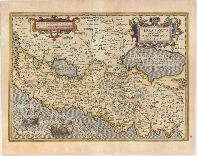
Title:
“Terra Sancta quae in Sacris Terra Promissionis ol: Palestina”
Map Maker:
Mercator/Hondius
East is at the top of this striking map of the Hol... (full text available to subscribers)
| Item Detail |
| |
| |
MapMaker: |
Mercator/Hondius
|
|
| |
| |
Subject: |
Holy Land |
|
| |
Period/Size: |
1618 / 14.1" x 19.6" (35.9 x 49.8 cm)
|
|
| |
Color: |
Colored
|
|
| |
Condition: |
(A) A fine impression with attractive color and a number of small worm holes and tracks that have been professionally repaired with a minute amount of image replaced in facsimile. (condition help) |
|
| |
Source: |
Theatrum Geographiae Veteris |
|
| |
References: |
Laor #494; Van der Krogt (Vol. I) #8150:1A. |
|
| |
|
|
| Sales Information |
| |
| |
Price: |
|
|
| |
| |
Offered by: |
Old World Auctions |
|
| |
Catalog: |
Auction No. 151 - Antique Maps, Charts, Atlases & Globes (9260) |
|
| |
Lot/Item #: |
607 |
|
| |
| |
Date: |
11/2014
|
|
| |
| |
|
Antique Maps - Valuation and Pricing, Descriptions, Resources |
|
Home |
Information |
Search |
Register |
Contact Us |
Site Map
Americana Exchange, Inc. © 1999 - 2024 Americana Exchange, Inc.. All rights reserved.
OldMaps.com, the OldMaps.com logo and
AMPR are service marks or registered service marks of Americana Exchange, Inc..
|