Title:
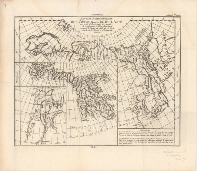
“Nouvelle Representation des Cotes Nord et Est de l'Asie pour Servir d'Eclaircissment aux Articles du Supplement de l'Encyclopedie...”
Map Maker:
Didier Robert de Vaugondy
Interesting map of the northeast coast of Asia dep... (full text available to subscribers)
| Item Detail |
| |
| |
MapMaker: |
Didier Robert de Vaugondy
|
|
| |
| |
Subject: |
Northern Asia |
|
| |
Period/Size: |
1772 / 11.8" x 15.2" (30.0 x 38.6 cm)
|
|
| |
Color: |
Black & White
|
|
| |
Condition: |
(B+) A dark impression issued folding with faint damp stains that enter into the image at top. The sheet has been remargined with old paper at left. There are old ink notations outlining Japan and Korea in inset No. I. (condition help) |
|
| |
Source: |
Diderot's Encyclopedia (Supplement) |
|
| |
References: |
Pedley #402. |
|
| |
|
|
| Sales Information |
| |
| |
Price: |
|
|
| |
| |
Offered by: |
Old World Auctions |
|
| |
Catalog: |
Auction No. 151 - Antique Maps, Charts, Atlases & Globes (9260) |
|
| |
Lot/Item #: |
623 |
|
| |
| |
Date: |
11/2014
|
|
| |
| |
|
Antique Maps - Valuation and Pricing, Descriptions, Resources |
|
Home |
Information |
Search |
Register |
Contact Us |
Site Map
Americana Exchange, Inc. © 1999 - 2024 Americana Exchange, Inc.. All rights reserved.
OldMaps.com, the OldMaps.com logo and
AMPR are service marks or registered service marks of Americana Exchange, Inc..
|