| Item Detail |
| |
| |
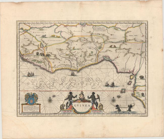
MapMaker: |
Willem Blaeu
|
|
| |
| |
Subject: |
Western Africa |
|
| |
Period/Size: |
1664 / 15.1" x 20.7" (38.4 x 52.6 cm)
|
|
| |
Color: |
Colored
|
|
| |
Condition: |
(B+) A nice impression with attractive color and wide margins. There is light printer's ink residue, a few small spots in the image, and a light damp stain at bottom left, away from image. (condition help) |
|
| |
Source: |
Grooten Atlas |
|
| |
References: |
Goss (Blaeu) #63; Norwich #315; Van der Krogt (Vol. II) #8700:1B. |
|
| |
|
|
| Sales Information |
| |
| |
Price: |
|
|
| |
| |
Offered by: |
Old World Auctions |
|
| |
Catalog: |
Auction No. 151 - Antique Maps, Charts, Atlases & Globes (9260) |
|
| |
Lot/Item #: |
690 |
|
| |
| |
Date: |
11/2014
|
|
| |
| |
|