Title:
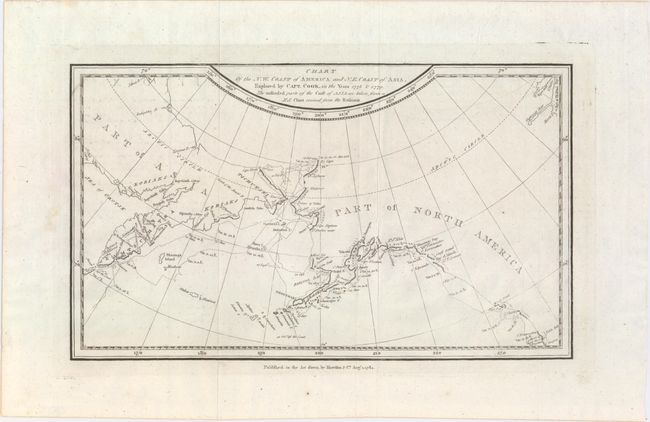
“Chart of the N.W. Coast of America and N.E. Coast of Asia, Explored by Capt. Cook, in the Years 1778 & 1779...”
Map Maker:
John E. Harrison
This map shows the coastline of northwestern North... (full text available to subscribers)
| Item Detail |
| |
| |
MapMaker: |
John E. Harrison
|
|
| |
| |
Subject: |
North Pacific Ocean |
|
| |
Period/Size: |
1784 / 7.4" x 12.5" (18.8 x 31.8 cm)
|
|
| |
Color: |
Black & White
|
|
| |
Condition: |
(A) Issued folding on watermarked paper with faint offsetting from an opposing page. (condition help) |
|
| |
Source: |
The Geographical Magazineģ |
|
| |
References: |
Kershaw #1145; McCorkle (18th C. Geography Books) #268-22; Shirley (BL Atlases) G.MRT-1a #31. |
|
| |
|
|
| Sales Information |
| |
| |
Price: |
|
|
| |
| |
Offered by: |
Old World Auctions |
|
| |
Catalog: |
Auction No. 151 - Antique Maps, Charts, Atlases & Globes (9260) |
|
| |
Lot/Item #: |
702 |
|
| |
| |
Date: |
11/2014
|
|
| |
| |
|
Antique Maps - Valuation and Pricing, Descriptions, Resources |
|
Home |
Information |
Search |
Register |
Contact Us |
Site Map
Americana Exchange, Inc. © 1999 - 2024 Americana Exchange, Inc.. All rights reserved.
OldMaps.com, the OldMaps.com logo and
AMPR are service marks or registered service marks of Americana Exchange, Inc..
|